
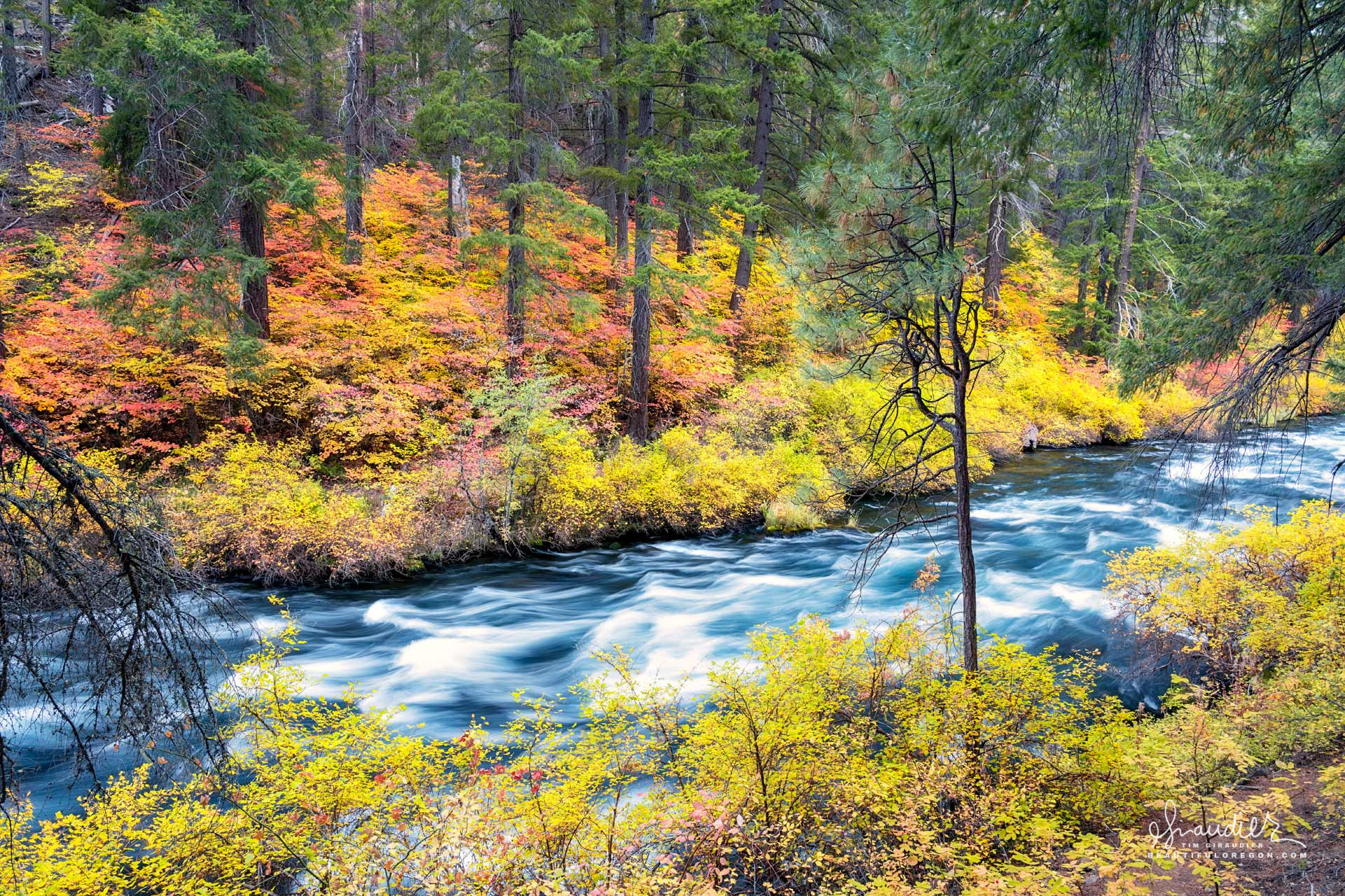
Metolius River – Central Oregon
$ 49.50
& Livraison gratuite plus de 60€Metolius River – Central Oregon, Late October: Long nights in car, sleeping-waking, warm, and waiting for dawn. Outside the forest glows softly, tinged silver, and bathed in cold moonlight. I hear my alarm and awake an hour before first light. The sound of river, steel cup on stone, the strike of a match, blue fire and coffee in hand. Moving quickly down a frosted path, the mute colors of dawn yield to autumn splendor, and the warmth of our beautiful star. The Metolius River, located in Central Oregon’s Deschutes National Forest, is a clear, spring-fed river renowned for its stable flow, cold temperatures, and pristine ecosystem. Originating from Metolius Springs at the base of Black Butte, the river emerges fully formed, an unusual characteristic that distinguishes it from many other rivers fed by mountain snowmelt or tributaries. The Metolius flows northward for approximately 29 miles before joining Lake Billy Chinook, a reservoir formed by the confluence of the Deschutes, Metolius, and Crooked rivers.The river is primarily fed by a series of cold, underground aquifers originating in the Cascade Mountains, which supply a consistent flow throughout the year, averaging around 1,500 cubic feet per second. The Metolius’s cold, stable water temperature, typically ranging from 45 to 50°F (7 to 10°C), supports a thriving ecosystem and makes it particularly suited for cold-water fish species, including native populations of rainbow trout, the endangered bull trout, and a fall run of Kokanee salmon. The Metolius is also noted for its exceptional water quality, with low turbidity and high oxygen levels, factors critical to its diverse aquatic life. Geologically, the Metolius River Valley is underlain by volcanic rocks, primarily basalt and andesite flows, which are characteristic of the region’s volcanic history. These porous volcanic deposits allow precipitation from the Cascade Range to percolate into underground aquifers, eventually emerging at Metolius Springs. The river valley is flanked by steep, forested slopes composed of Ponderosa pine and Douglas fir, and the area is dotted with basalt outcroppings and cinder cones which reveal the volcanic processes that shaped the region. The Metolius River holds a rich history of use by Native American communities long before European settlement. This spring-fed river, with its stable flow, cold temperatures, and abundant resources, supported Indigenous populations for thousands of years. With its strategic location near the eastern slopes of the Cascade Range, the Metolius provided food, materials, and a cultural gathering place for the region’s tribes. When European settlers arrived in the 19th century, they brought significant changes to the landscape and resource use, shifting the region’s human-environment dynamics. The evolving interaction between Native American practices and European settlement demonstrates how different cultural approaches to resource management shaped the Metolius River’s history. For Native American communities, including the Warm Springs, Wasco, and Paiute tribes, the Metolius River was both a crucial resource and a sacred landscape. The river supported large populations of native fish species, including Chinook salmon, steelhead, rainbow trout, whitefish, and bull trout. These fish formed an essential part of the Indigenous diet and were central to the seasonal food-gathering practices of the local tribes. The riverbanks, rich in plant life such as alder, willow, sedge, and various medicinal plants, provided materials for basket weaving, clothing, and medicine. The surrounding forested landscape, dominated by Ponderosa pine, also offered timber and materials for shelter, tools, and crafts, enabling sustainable living along the river. The Metolius was a cultural nexus for Indigenous communities, serving as a place for seasonal gatherings, trade, and cultural rituals. Fishing techniques along the river were highly developed, with tools such as spears, nets, and fish traps that allowed for efficient, selective harvesting. The river was managed sustainably, with tribes often practicing fishing restrictions to allow fish populations to regenerate. Spiritual beliefs tied to the river and its resources also underscored a respectful approach to resource use, integrating an understanding of the river’s ecological cycles with cultural practices. For these communities, the Metolius was more than a food source; it was part of a broader cosmology that connected people to the land, water, and natural processes. The arrival of European settlers in the 19th century brought profound changes to the Metolius River and its surrounding ecosystem. As settlers moved westward, encouraged by land grants and the promise of fertile land, they began to alter the landscape around the river. The European approach to land and resource use contrasted with Indigenous practices, as settlers pursued agriculture, livestock grazing, and logging, which affected the river’s ecological balance. Irrigation projects were introduced to support agriculture, diverting water from the river to feed crops, which reduced the river’s natural flow. Logging in the surrounding forests also impacted the watershed, as the removal of trees increased erosion, sedimentation, and runoff, potentially affecting the river’s clarity and water quality. Fishing practices changed as well with European settlement. The growing population increased fishing pressure, and techniques like gill netting and trapping replaced Indigenous selective harvesting methods. Overfishing, along with disruptions to the river’s flow from irrigation and damming, began to reduce native fish populations, affecting species such as the Chinook salmon that once flourished in the river. In the early 20th century, fish hatcheries were introduced to artificially bolster fish populations, but these facilities sometimes introduced non-native fish species, altering the ecological balance and creating competition for native fish. The impacts of European settlement on the Metolius River prompted the development of conservation movements in the late 19th and early 20th centuries. Awareness of the river’s ecological decline led to discussions about the need to protect its resources, including preserving native fish populations and maintaining water quality. Conservation measures, such as fishing regulations, attempts to limit deforestation near the riverbanks, and the establishment of wildlife protections, were introduced in response to ecological pressures. These efforts eventually contributed to the river’s designation as a Wild and Scenic River, helping to preserve its unique ecosystem. Today, the Metolius River remains a vital resource, protected for its ecological, cultural, and recreational significance. While early European activities dramatically altered the river’s landscape and use, current management practices aim to restore and preserve its ecological balance, recognizing the importance of the Metolius to both Indigenous heritage and the natural landscape of Central Oregon. Efforts to protect the river now integrate aspects of traditional ecological knowledge, which emphasizes the careful management of natural resources that sustained Indigenous communities for generations. The Metolius River’s history, shaped by contrasting Indigenous and European perspectives, illustrates the complex interplay between cultural values and environmental stewardship. Autumn, Deschutes County, Deschutes National Forest, Metolius River, Vine Maple
Produits similaires
-
CAMERA PTZ CANON CR-N700 NOIRE $ 99.61