
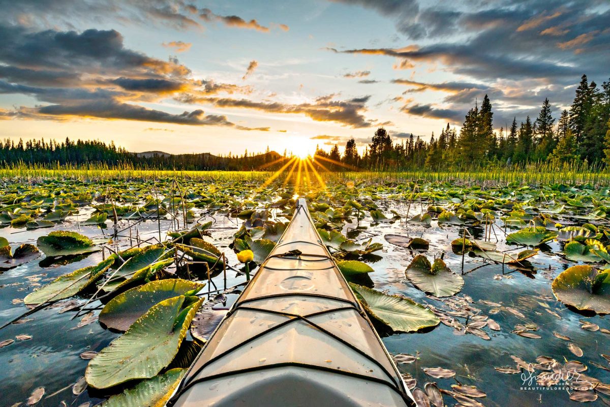
Hosmer Lake – Central Oregon Cascades
$ 49.50
& Livraison gratuite plus de 60€Amidst a cacophony of songbirds, insects and lily pads; a beautiful sunset unfolds on Central Oregon’s Hosmer lake. Formally known as Mud Lake, Hosmer is undergoing the process of succession as it fills in with sediments to slowly become a swamp, and eventually an alpine meadow. Currently Hosmer is popular for both paddle sports and fly fishing. Due to the explosive popularity of this fragile lake, tread lightly and give others space. Deschtues National Forest. Deschtues County, Central Oregon Cascades. Hosmer Lake, located at approximately 4,964 feet elevation in the central Oregon Cascades, occupies a shallow basin formed through a combination of glacial erosion and volcanic activity. The lake sits within the High Cascades volcanic province, and the surrounding terrain is primarily composed of young basaltic andesite lava flows and glacial deposits. The basin itself is interpreted as a glacially overdeepened depression, later impounded by Holocene lava flows originating from vents associated with the Mount Bachelor volcanic chain. Hydrologically, Hosmer Lake is fed by both surface and subsurface sources. The primary surface inflow is Quinn Creek, a perennial stream originating from snowmelt and springs at higher elevations to the northwest. Quinn Creek enters the lake at its northern end, delivering cold, well oxygenated water that supports aquatic macrophyte beds and coldwater fish populations. Additional water enters through localized spring discharge along the lake’s perimeter, and facilitated by the porous volcanic substrate. The lake is shallow, with an average depth of approximately 3 to 5 feet and maximum depths approaching 12 feet. The water column is typically clear and oligotrophic, reflecting minimal nutrient input, low turbidity, and modest primary productivity. The lake is divided into two lobes connected by a narrow channel, which facilitates limited internal circulation. Outflow occurs at the southeastern end of the lake via a human-modified channel controlled by an outflow gate. This structure regulates discharge into an unnamed stream that flows southeast toward Crane Prairie Reservoir. The gate is used to maintain lake levels and manage seasonal fluctuations in water volume, particularly during spring snowmelt and late summer drawdown. Subsurface seepage into the surrounding lava fields also contributes to water loss from the system. Paul Hosmer (1887-1962) Hosmer Lake was originally called “Mud Lake” because, before mid 20th century modifications, it was a shallow, silty marsh dominated by mud, peat, and carp. These carp stirred up the soft bottom, resulting in consistently turbid, muddied water and a landscape more swamp than lake . In 1957, the lake was treated with rotenone to eliminate Common Carp (Cyprinus carpio), and a small dam raised the water level by about four feet—transforming it into a clearer, deeper, more visually appealing body of water. This physical transformation prompted the change of name in 1962, when the U.S. Board on Geographic Names renamed it in honor of local naturalist Paul Hosmer. Paul Hosmer (1887–1962) was a prominent figure in early 20th century Central Oregon—a naturalist, writer, humorist, photographer, banjo player, and longtime resident of Bend. Originally from St. Paul Minnesota, he moved to Bend around 1915 to work with the Shevlin-Dixon lumber company. Over decades, he became well-known locally as the editor of Pine Echoes, the company magazine, and as an author—for instance, Now We’re Loggin’ (1930)—contributing humorous and insightful stories about lumberjacks and life in Oregon’s forests. He was also a dedicated outdoorsman and photographer—famously captured in a Life magazine photo taken at Devil’s Lake—and a banjo musician who led a local dance band . Deeply connected to Central Oregon’s Cascade environment, he frequented lakes like Elk and Mud, exploring, writing, and canoeing across the volcanic, marshy landscape. Hosmer passed away in January 1962. Later that year, the U.S. Board on Geographic Names approved changing the lake’s name from “Mud Lake” to Hosmer Lake in his honor—recognized for his contributions to local natural history and recreation advocacy in the Cascades. Fly-fishing for Rainbow and Cutthroat Trout at Hosmer Lake Perched at approximately 4,964 feet in the Deschutes National Forest, Hosmer lake is supplied year-round by cold springs rising through permeable volcanic flows, and by Quinn Creek, a snowmelt fed tributary entering the lake’s northern end . Together, these inflows maintain the lake’s clear, cold, and nutrient-poor conditions. The lake is divided into two broad basins, connected via a slender, reed-lined channel. The continual inflow from Quinn Creek enhances water circulation, particularly in the northern section, and complements the steady groundwater discharge by promoting subtle currents where aquatic vegetation and trout hold. The mix of surface and subsurface inflows helps sustain both open water and fringe wetlands—ideal conditions for trout feeding along submerged structures and channel edges. A fly-fishing-only designation, coupled with barbless hooks and mandatory catch-and-release, supports healthy populations of rainbow (often descended from Crane Prairie stock), cutthroat, and occasionally large brook trout. The lake’s low productivity encourages selective feeding behavior, which, in turn, demands precise fly presentation. Often, anglers employ chironomid and Callibaetis nymphs on indicators fished through shallow flats, or woolly buggers and leech patterns retrieved along the creek’s influence. During summer, hatches of caddis, damselfly nymphs, and terrestrials offer surface opportunities—most rewarding during calm morning and evening periods. Shallow depths, averaging 3–5 feet. and reaching 12 feet in deeper pockets, permit sight-based approaches with visible trout patrolling beneath the surface. Quietly maneuvering through channels and reeds via float tube, pontoon, or drift boat, anglers focus on subtle currents and structural breaks where creek inflows meet groundwater-fed flats. Electric motors are allowed only for positioning, preserving the lake’s hushed ambiance. Seasonal access varies; winter snows often block roads to late May or early June, and autumn chill begins in September. Spring and fall feature cooler water, peak trout activity, reduced recreational traffic, and excellent fishing conditions. In summer, visitors must adjust by fishing during early hours or choosing less accessible bays to avoid disturbance from paddlers and sunlight-driven algae growth. Surrounded by volcanic peaks—Mount Bachelor, South Sister, and Broken Top—the lake is enveloped by bulrush-filled wetlands and submerged logs. Quinn Creek’s inflow adds a layer of dynamic to the water body: shifting currents, slightly cooler inflow pockets, and a distinct corridor of trout habitat. Cascade Lakes Highway, Deschutes County, Deschutes National Forest, Hosmer Lake, Kayak, Sunset
Produits similaires
-
Camera Canon ME20F-SHN $ 90.46